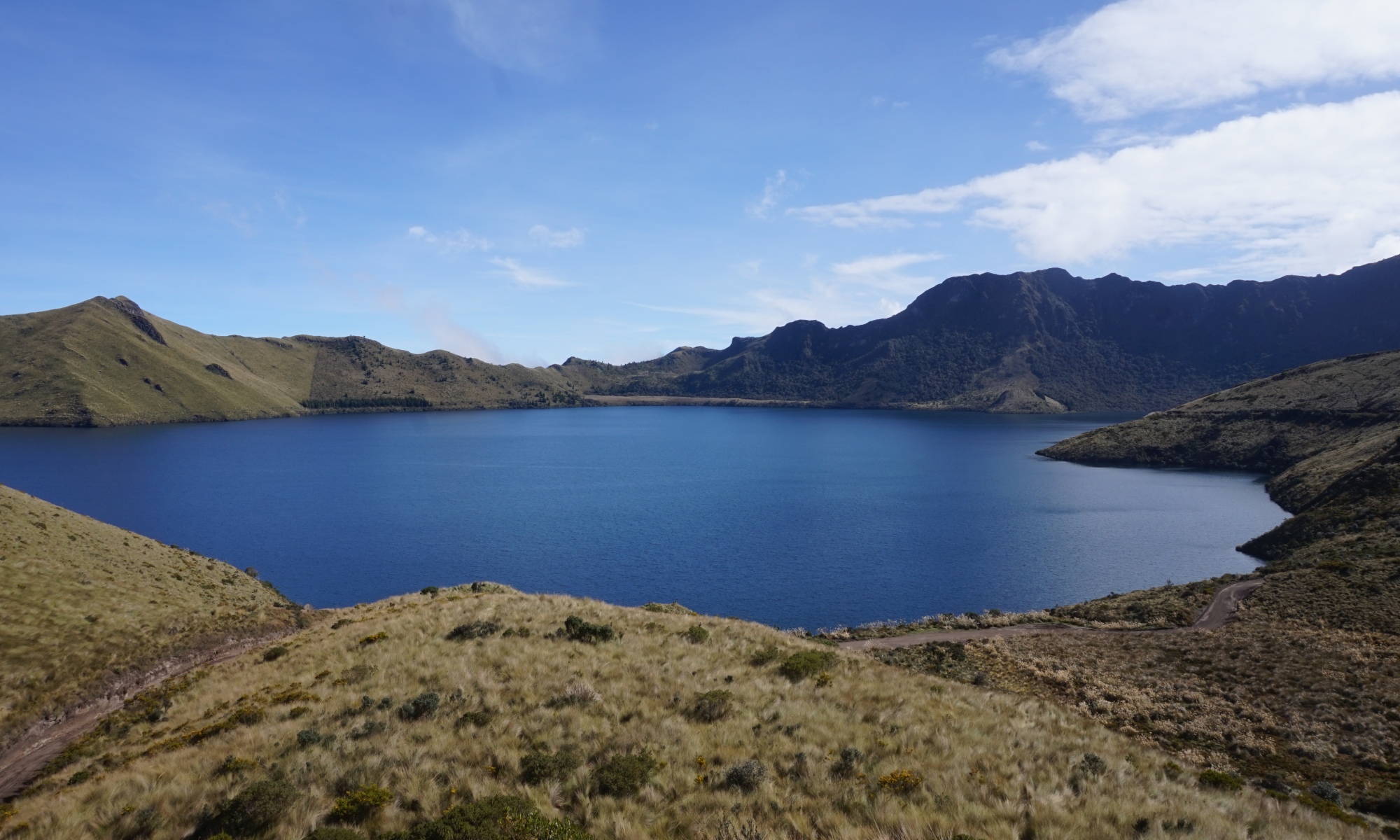
About 15 kilometres outside of Otavalo we found a small gem of a protected area called Mojanda. As far as we understood it is a volcanic crater containing a number of lakes, lava domes, and at its edge the volcano Fuya Fuya.
Most tourists we met came there to climb Fuya Fuya and to take pictures of the biggest lake near the entrance. However, there are also flatter great hikes as well, and as most tourists seem to be day-trippers, you will have splendid opportunities to stargaze on your own.
The landscape is hilly and páramo like, and in early October it takes on a mysterious and dangerous look with mist and clouds. Extremely beautiful in its own way!
How to get there — and away
We did not find any public transport options any further than Mojandita. That leaves you with the options of hiring a taxi, walk, or hitchhike.
Going there:
Taxi: We asked our accommodation (Hostería Rose Cottage) to get us a taxi. They seemed to operate with a fixed price of 15 USD to get there. As we understood, this is mainly due to the rough road, not the distance (though, you shouldn’t be worried if you go by your own car — it wasn’t that bad 🙂).
Walk: It is definitely possible to walk there from Otavalo, but it will be a long, uphill walk where you gain 1200 altitude meters. If walking you can consider taking the bus to Mojandita leaving the Otavalo Bus Terminal approximately every 40 minutes costing 0.35 USD. This will save you approximately 4 km of walking.
Hitchhiking: You should always be very careful when hitchhiking! That said, it seemed like the norm on this rote that cars passing by would at least slow down for you to wave at them if you would like a ride. However, after the first 4-5 km the road is blind — only going to the Mojanda lakes. So you shouldn’t expect many cars unless it’s weekend, where the Ecuadorians seems to like going for a walk in nature.
Going back:
Taxi: You can either ask you driver to come back for you at a specific time, or you can count on taking a taxi back when it comes with new loads of tourists and/or locals. The last option works best if you plan to go back before/around noon and specially on weekends. You can also hope for somebody else have an agreement with a taxi and a free spot for you. Again, that works best on weekends when more people go to the lakes.
Walk: Going back it is a downhill walk back to Otavalo (or Mojandita and the bus back to Otavalo). To Mojandita it is about 11 km all downhill. Do not underestimate that it is a steep walk, so consider twice if you have problems with your knees or a heavy backpack.
Hitchhiking: Again, be careful! But if you feel like hitchhiking we have the same observations for going back as for going there.
Camping
As far as we could find you are allowed to camp everywhere other than in the protected area around Laguna Chiquita (Laguna Chirlacu). Here it is clearly signposted that camping is not allowed.
It is cold up here, 3700 altitude meters, so bring a good sleeping bag. Be prepared for rain as well.
Bring all you need for wild camping, and take out everything to keep the area nice and clean 🙂. There are no facilities for camping etc. besides the picnic area near the entrance.
However, opposite the entrance on the other site of the big lake there is some kind of hostería offering accommodation and camping if you don’t feel like camping in the wild.
Water wise the biggest lake, Laguna Grande (Laguna Caricocha), seemed to be the best option. Laguna Chiquita had very low water levels, and was very muddy. We did not check Laguna Negro (Laguna Huarmicocha). No matter where you take your water from we suggest that you purify it.
Hiking in the area
As mentioned many tourists come to climb Fuya Fuya. But there are many other options which are much more flat. We hiked around Laguna Grande, up to the viewpoint near Cerro Negro, and back on the opposite side of Cerro Negro to Laguna Chiquita, where we camped outside of the protected area.
You should note though that the trail north around Laguna Grande is very difficult to follow and takes you through several wet, swampy areas, followed by an exhausting hike through a dense forest. You will need time, snacks, and good orientation skills to do this part. We were only able to follow the path with a GPS guiding us to where the path was meant to be.
Ideally, bring the topographical map sold by Tatoo or Instituto Geográfico Militar in Quito (or available for download from their website) in combination with an offline map with the trails (e.g. maps.me) and your phone’s GPS (and your power bank 🙂).
The area is not very big, so our guess is that you can only be busy hiking for two days in the area. We can highly recommend going early in the morning and/or camping so you get the great morning sunshine before the clouds come in.
We hope you will enjoy Mojanda as much as we did! Please let us hear about it. If you have any questions, send them as well, and we will be happy to answer.
October 2018

